Fraunhofer Institute for Transportation and Infrastructure Systems IVI
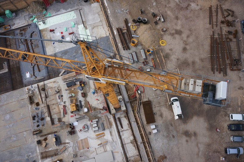
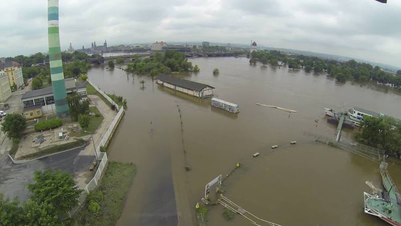
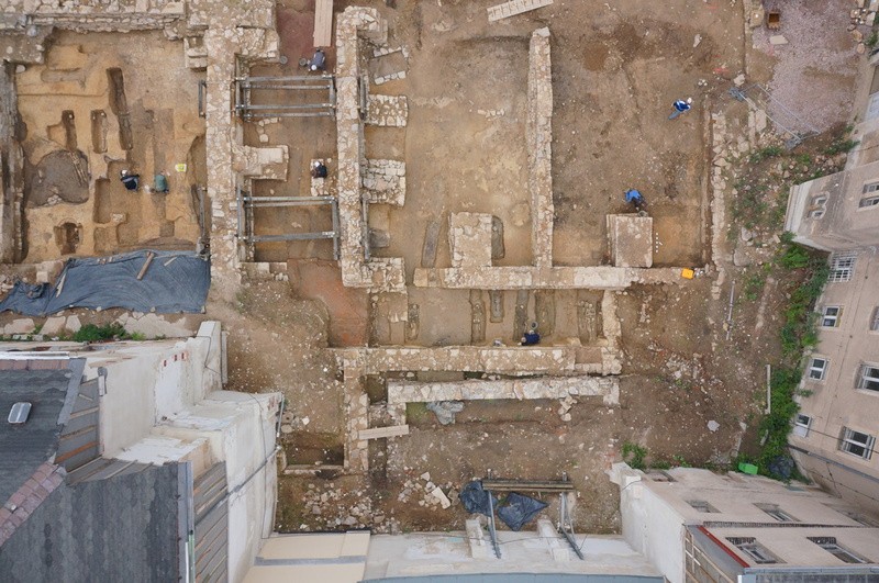
The bird’s-eye view from above is not only impressive, it also helps to maintain an overview of things. With the HORUS® multicopter, it is possible to take aerial pictures (both RGB and infrared) from low altitudes (1 m to 250 m). Combined with a high-resolution digital camera, richly detailed overview images can be generated.
Another advantage is the reproducibility of flights, meaning that the multicopter is able to follow a predefined route and repeatedly produce images from the same perspectives. This feature is especially interesting for the documentation of construction progress or other temporal changes.
Practical examples:
- Documentation of the construction progress during the Elbe river tributary renaturation
- Documentation of the Elbe floods in 2013
- Documentation of the excavation site of the Dominican monastery St. Pauli in Freiberg